
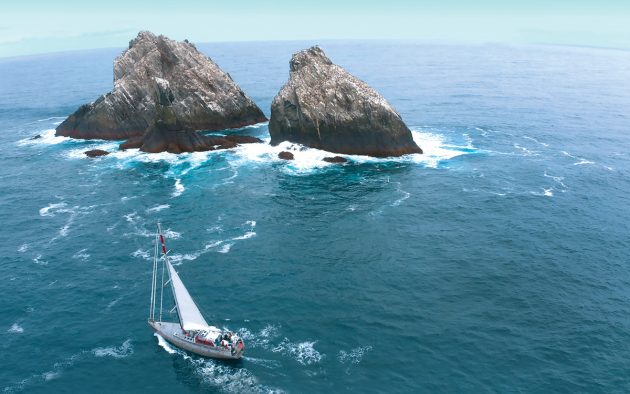
Skip Novak provided logistic support for an ambitious scientific mission to the remote South Sandwich Islands archipelago of the southern ocean
The rule of thumb when doing these tricky inflatable beach landings is to hang in above the surf line for a good ten minutes to watch the sets coming through. Maybe we were a bit premature, but I gave Thomas, the boat handler from Pelagic Australis, the thumbs up to drive the Bombard C5 ashore.
We surfed into the cobbled beach and before we could turn the boat around it was flooded by the next breaking wave. Our survival gear in dry bags floated to the surface and, waist deep, we snatched them out and ran them up above the surf, stumbling like drunks and slipping and sliding on the football-sized boulders.
The term beach was definitely a misnomer. Having bailed out the C5, we pushed Thomas into a backwash but he was caught by a breaker beam on and came close to capsizing. Only his aggressive and expert boathandling saved the day and he made it back out to Pelagic Australis a half-mile offshore, rolling heavily in mist in the wide mouth of the bay.

Turning the inflatable around immediately is the only way to prevent flooding. Dry suits are de rigeur
Clearly this stretch of the coast was a non-starter for getting the rest of our team and equipment ashore. We watched as big breakers came in one after another. Even with the line system we had developed to pull gear in and back out from the dinghy, the chance of someone getting dumped on their heads on rocks was too great.
We had tents, food and fuel, which is always first in and last out, but although three of us had their personal gear drybag with clothing, mine had mistakenly been left on board, slated for the next trip. I was in a dry suit, hoodie and booties and felt slightly vulnerable in what was looking like a stranding ashore. As I ripped off the hoodie and felt the chill wind, I realised the lack of my ‘lucky hat’ was an unwelcome portent.
Below the Polar Front
We had landed on the very open beach of Kraken Cove on Candlemas Island, which lies in the north central section of the South Sandwich Islands chain. Here, it is all about plate tectonics. The 180-mile long arc of 11 volcanic cones, some active, along with outliers demarcates the eastern margin of the Sandwich Plate. This balances on the edge of the 7,400m deep abyss of the South Sandwich Trench.
Article continues below…

Sailing round Cape Horn with Skip Novak: An introduction
Get a sneak peak of our brand new series on storm sailing round Cape Horn with Skip Novak

Sailing South Georgia: The inside story of Skip Novak’s 2018 expedition
We were eight days out from the south coast of South Georgia and once again we had skied smack into…
The trench is a subduction zone – the South American Plate to the east is diving under the Sandwich Plate and creeping west at an average of 70mm per year. This dynamic interface releases magma from the earth’s crust, which rises and gives birth to these volcanic islands and associated sea mounts.
Zavodovski Island, the northern most and most active, is 300 miles south-east of the southern tip of South Georgia. We were truly deep in the Southern Ocean at 57°S, well below the Polar Front.
The South Sandwich Islands Expedition had sailed with us from Port Stanley in the Falklands on 30 December. Specialists for volcanology, climate change, penguin biology and whale identification and acoustics were on the team, plus two filmmakers. Candlemas Island was on everyone’s hit list with its smoking crater to be studied, chinstrap, Adélie and macaroni penguins to be counted and vestigial glaciers waiting to be drilled for ice cores.

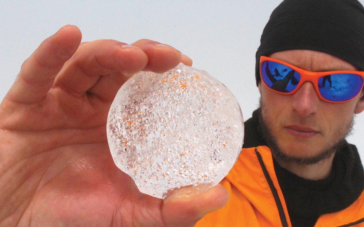
Professor Paul Mayewski and Mario Potocki from the University of Maine Climate Change Institute drilling ice cores on South Georgia
Now it was already mid-afternoon and we had no choice other than to walk the kilometre around the length of the bay on those awkward boulders to the spit named Demon Point that defines the eastern side of Kraken Cove, in hopes of finding doable surf. This meant several trips to bring the survival gear around and by the time this was accomplished it was obvious we’d have to abort the landing. Time had run out.
Luckily, the surf under Demon Point was safe enough in between huge sets that ripped around the spit to get a throw line ashore from the C5 so we could be towed back out, one by one, with a gear bag each.
Back on board we had a debrief and were convinced that if the swell did not increase next day we could get a slimmed down version of Team Volcano ashore with a few of us in support. Under the circumstances we had to scrub taking Team Penguin ashore; they could fly the drone from the deck to census the colonies. Also, Team Ice would have to take a pass with their heavy drilling gear.
We were 14 on board, more than a full house, which meant elbows tucked in at the main saloon table while eating our dinner as usual from bowls – not plates – in the unpleasant roll. This had been a feature of every anchorage we had been to thus far.
As always, optimism had run high when we set sail from the Falklands. As soon as we cleared Cape Pembroke, Ted Cheeseman, the co-founder of happywhale.com, was letting out his 400m of Spectra with the acoustic probe to log whale noise. These data files would be translated by algorithms to identify the species heard.
This was a passive bit of research, until it was time to reel in to download the chip. That took 40 minutes of grinding on the three-speed winch. We all had to pitch in to get some exercise. On this trip, Ted would log 33 humpback tail fluke photos for his global database.

Ted Cheeseman deploying the acoustic probe to record whale ‘noise’
We’d sailed 1,000 miles to reach the islands but that would be the easy part, running before the prevailing westerlies in a spell of fine weather, often double poled out with the mainsail down. It was settled enough for Dr Emma Liu and Dr Kieran Wood, of University College London and Bristol University respectively, to rig up their drone on the saloon table.
This was a quadcopter big enough to carry their ad hoc gas sensor. This device was to be flown in the gas plumes of the craters to measure CO2 and SO2. They were slightly shocked when firing this gizmo up that the level of CO2 in the main saloon was somewhat above the recommended background level. I dutifully opened a few hatches.
Although this was a charter it was clear in order to pull off the objectives that our sailing crew would have to help facilitate the science and the scientists would have to help us sail and run the boat.

Researchers learning the ropes on the way to South Sandwich
Captain Chris Kobusch and his mate, Sophie O’Neill, on their first season south and fresh from Clipper Ventures, knew how to build the team. Thomas Geipel, a Pelagic veteran of many seasons, was seconded in specifically to do the boat driving, which would be more than challenging. These three got everyone, including the landlubbers, busy working the sails, cooking, washing up and lending a hand where needed.
My role was over-arching expedition leader in charge of safety and calling the landings in addition to mountain safety for Team Volcano. Coordinator of the science disciplines was Dr Tom Hart, a penguinologist from Oxford University and the mastermind of this project.
Tom, Jo Feldman, an A&E doctor from California, and Gemma Clucas, a post doc from Cornell University working with Tom (Team Penguin) had all been to the islands before. Tom is possibly the only human to have landed on all the main islands during his three previous expeditions. So we had plenty of chiefs, but luckily still enough Indians to go around.

Chinstraps share this stretch of beach at Ferguson Bay on Thule Island with Adélie penguins
Citizen science
Tom had been working on a plan for this project for the last three years. Of particular note was that in the southern autumn of 2016, Zavodovski had violently erupted so the fate of the 1.3 million pairs of chinstrap penguins, recognised as the largest vertebrate colony of any species in the world, was unknown. Were they buried in ash, or had they already moulted and gone to sea for the winter? Tom was dying to find out.
Tom is a pioneer of using hunting camera traps to record activities at penguin colonies throughout the year. This is impossible to do by researchers for reasons of climate conditions, cost and time.
Over the last ten years through his Oxford-based project he and his collaborators have placed in the order of 150 cameras at sites all around the Southern Ocean. These are downloaded and batteries changed annually, if possible. The team is supported by cruise ship and yacht logistics.

Drone flight above the chinstrap colony on Nattriss Point, Saunders Island. Photo: Tom Hart
The millions of images are then collated by the penguinwatch.org citizen science programme. It’s popular with school children, but anyone can log on to help count penguins. Historically, penguins were counted with boots on the ground by hand with a clicker or, if the colony was too vast, estimates were made by density calculations from photographs taken.
With geo-referenced drone flights, large and awkwardly placed colonies can be recorded and now recognition software does the counting. The accuracy and time efficiency are a gamechanger.
The southernmost island group aptly named South Thule is 200 miles south of Zavodovski and sits just above 60°S on the edge of the winter sea ice band around the Antarctic continent. The South Sandwich Islands are not in the Antarctic Treaty territory but the UK, which owns this stretch of hostile real estate, is strict in its governance.

Managed from Port Stanley the islands, along with South Georgia, are officially called the UK Overseas Territory of South Georgia and the South Sandwich Islands.
To visit South Sandwich is a hoops and ladders exercise of bureaucracy and visits are limited to scientific expeditions.
The land masses are a Specially Protected Area and the waters in the maritime zone include a Marine Protected Area and specific No Take Zones for licensed fishing in the wider maritime zone. This is critical to protect krill stocks for seals and penguins.
Pristine islands
A rigorous permit process is in place. The two top items on the government’s agenda are biosecurity and safety. You have to document and demonstrate you will not be introducing alien species to these otherwise pristine islands, and you have to ensure you can conduct the expedition safely and be self-sufficient.
Before we left Stanley we inspected everyone’s clothing, footwear and equipment, vacuumed out pockets of jackets and trousers, and painstakingly picked seeds out of Velcro. We disinfected boots, ski poles, tripods and anything else that could touch the ground.
We had to be hard on each other, and it’s amazing what you can find if you look hard enough. Before setting sail, we were visited by Sammy, the official four-legged rat catcher in Stanley. She jumped back ashore still hungry.
As we approached Saunders Island after the five-day transit, I remembered what one pundit in Stanley who’d been to these islands twice before said to me: “You have too many people and you’ll be lucky to get 10% of the objectives done.”

An attempt to climb Mt Belinda on Saunders was thwarted by savage weather
He had good reason to be pessimistic. I was bracing myself for days hove to offshore in gale conditions among growlers and bergy bits while waiting to land, with time running out and a boatload of anxious researchers suffering from cabin fever.
Late in the evening of 4 January we ghosted around the northern end of the island. At daybreak we anchored in 15m in the open roads of Cordelia Bay. While searching for the terra incognita of Antarctica in 1775 Captain Cook and HMS Resolution fetched up on a group of islands to the south, which he aptly named Southern Thule.
Sailing north, he went from island to island up the chain to Candlemas, assuming, in the thick weather, that he was looking at promontories of a landmass.

Skip in his ‘lucky hat’ directing the line system to pull gear and people into the beach on Bellinghausen Island. This keeps the inflatable outside the surf, but it’s still a risky manoeuvre. Photo: Mariusz Potocki
Not until 1819 when Captain Thaddeus von Bellingshausen discovered the northern three islands and then sailed south along the eastern side of the southern islands was Cook’s theory of a land mass discredited. Various sealing expeditions came and went up to 1830 with not much profit, and then it was not until 1908 when Captain Larsen, who developed the whaling industry on South Georgia, landed on Zavodovski.
They were now firmly on the map, but all attempts at whaling and sealing failed due to the harsh weather and lack of any natural harbour, so they stayed pristine.
Following the footsteps
Following in the footsteps of only a handful of previous scientific parties that have landed, we wasted no time to get ashore. Our first ‘wet landing,’ jumping out of the C5 Bombard in waist-deep water to turn the boat around and offload, was an easy one.

Mario Potocki strolling up to the crater rim on Bellinghausen Island to assist Team Volcano
With 11 of us all ashore, the scientists took off in different directions with me in hot pursuit of the two young volcanologists, Emma and Kieran. Tom, Gemma and Dr Jo were flying drones over the penguin colonies, satellite tagging 20 chinstraps to record foraging ranges and taking faecal and blood samples for DNA analysis.
Pelagic veterans Professor Paul Mayewski and Mario Potocki from the University of Maine Climate Change Institute went in search of ice with their drilling gear, and also water and snow samples to demonstrate levels of pollution. Don’t believe it? In the Antarctic this team has discovered levels of uranium in melt water conclusively linked to an open pit uranium mine in Australia.
Ruth Peacey and Hamsa Yassin, our film team, had a lot on their plate to cover. We all kept an hourly radio sched while Chris on board kept us informed of any changes of weather, which meant we would have to call in the troops and evacuate in double quick time.

Dr Kieran Wood and Dr Emma Liu on Saunders Island
The strange thing was, the weather was fine that day and lasted two days more, giving us all ten hour days on shore and loads of data in all the disciplines. Tom was particularly pleased as one of the three camera traps he’d serviced in December 2014 had survived the eruption in 2016 and when he downloaded the chip the series of images had gone black, which narrowed down the time of eruption to the first week of April.
The only downside was because of gale conditions above 500m we couldn’t access the crater on Mt Belinda where a lava lake was rumoured to be. This was one of the Holy Grails of the expedition – unfinished business.
During the next eight days we kept pinching ourselves as the weather held fine so that we could move from island to island at will. We landed on Thule, Bellingshausen and Candlemas. On Cook, Bristol and its outliers and Zavodovski, Tom flew the drone from the deck with Gemma launching and catching – no mean feat in swell and wind. The good news was Tom knew the eruption on Zavodovski in 2016 had spared the colony.

Job done: the assembled team in the cockpit of Pelagic Australis on their return to Port Stanley, Falkland Islands
After eight days of fine weather on the South Sandwich we high tailed it to the relatively tropical coastline of South Georgia. Here we cherrypicked other objectives on foot and by drone in the time that was left. Back in Stanley after five weeks in the field, Pelagic Australis’s job was done, but the scientists’ work back in their labs was yet to begin.
 About the author
Skip Novak is a veteran ocean racer who has spent the last three decades sailing in Antarctic waters with his Pelagic expedition yachts. As well as running adventure charters he regularly facilitates and provides support for scientific field research.
First published in the June 2020 edition of Yachting World.