
Russia’s ‘grey zone’ activity in the Baltic, from GPS interference to aggressive shadowing, is unsettling sailors. Will this be the new normal, asks Elaine Bunting?
“Look, Gerd… what is that? Is it a boat? Is it moving?”
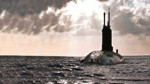
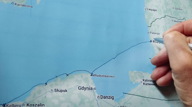
Anke Schekahn was on watch with her husband, sailing their Malö 40 Emaloca from Władysławowo in northern Poland, to Klaipėda in Lithuania, on their way to Estonia early in the summer of 2025. In the far distance was the coast of Kaliningrad, the Russian exclave wedged between Poland and Lithuania on the Baltic Sea.
The German couple were transiting through Russia’s Exclusive Economic Zone, but outside the 12-mile territorial limit, when she saw a strange looking silhouette on the horizon.
Neither of them could make sense of the low, dark object until it came closer. As it approached, they realised it was a partially surfaced submarine. The submarine altered course toward them and closed at an angle, then reduced speed to match the yacht’s. It was close. The conning tower and periscopes looked threatening. Gerd called on the radio, but there was no reply.
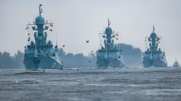
Russian naval ships on parade in the Gulf of Finland. Photo: Artem Priakhin/SOPA Images/LightRocket/Getty
“My knees started shaking uncontrollably and my mouth was dry. I didn’t dare take a photo. It felt eerie to see no person at all but to know that we were being watched,” Anke wrote on the blog of their Baltic cruise (emaloca-segelt.de) to an Estonian singing festival.
The couple were now frightened. Were they being monitored, would the submarine pass by, or were they being purposely intimidated?
They tacked Emaloca away. The submarine followed, then continued on a parallel course. Eventually it crossed their path and continued on its way, but the Schekahns were shaken, cleared well offshore and resolved never to go back. Some time later, they heard a Polish sailor on Ch16 warning about a Russian warship that tried to push him off course.
For some years Russia has been flexing its might in the Baltic. Many NATO countries are feeling the effects of Russia’s hybrid war and threats to everything from internet stability and energy to transport infrastructure.
‘It felt eerie to know that we were being watched’ Photo: Johner Images/Alamy
The Baltic has become a contested zone, with reports of anchor-dragging, suspected sabotage and interference with navigation and communications systems.
A ‘shadow’ fleet of mostly Russian-owned tankers flying flags of convenience plies the Baltic and beyond to circumvent sanctions, conduct surveillance and, maybe, to instil uncertainty and fear.
But it is also one of the most serene and beautiful cruising waters in the world, so how real is the risk, and what can you do to stay safe?
Baltic cruisers, are you where you think?
This is far from the only threat. GPS jamming and spoofing have become everyday and endemic in the eastern Baltic and in other conflict zones, and it has a significant impact on safety of navigation, communications and distress and man overboard equipment.
In November, Norway’s foreign ministry explicitly warned that Russia is jamming GPS systems, especially in the northern part of the country. “At our border region, there is almost continuous GPS jamming or spoofing going on, making it hard for civilian traffic – including, for example, air ambulances,” stated Eivind Vad Petersson, a state secretary in the foreign ministry.
While the Baltic is the most obvious hot zone, other parts of the world – such as the eastern Mediterranean near Israel and Gaza – are also being affected in ways that sailors need to be aware of.
Jamming floods the GPS frequencies with noise so receivers can’t lock on to real signals.
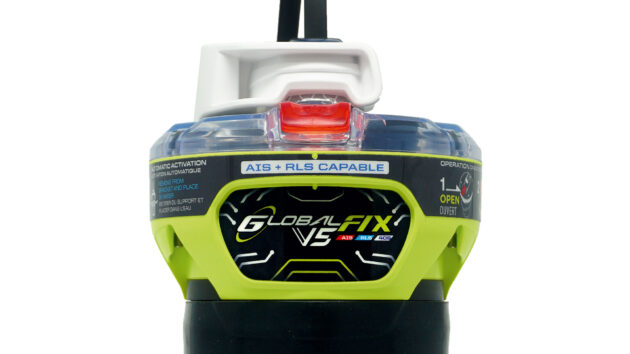
For yachtsmen, a modern 406MHz EPIRB is still one of the most dependable pieces of safety gear you can carry.
Spoofing is more insidious: it broadcasts fake GPS data to mislead ships, aircraft, or vehicles into thinking they are somewhere else. Both can disrupt navigation and critical systems that depend on precise location data. That includes satellite communications systems, which lock onto a specific satellite using precise frequencies and timing.
Spoofing or jamming can also seriously undermine emergency beacons because those devices rely on Global Navigation Satellite Systems, such as GPS, Galileo and GLONASS, to figure out where they are before they send a distress signal. If the GPS feed is wrong or unavailable, a distress system or PLB can transmit coordinates that are inaccurate, miles off, or completely missing.
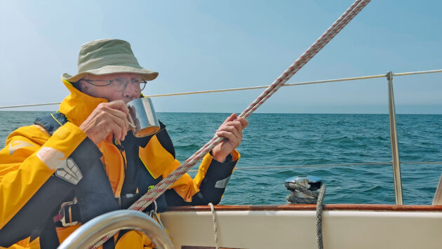
The Schekahns enjoying a more typically peaceful Baltic mooring spot in Finland’s Turku archipelago, tying up bow-to with their Malø 40. Photo: Gerd & Anjke Schekahn
“In effect, GNSS and AIS are under cyberattack in these regions and, from a safety point of view, you don’t want to rely on signals we know are being messed with,” says Ramsey Faragher, president of the Royal Institute of Navigation. “You need to understand thoroughly how your own safety of life systems work as there are man overboard and PLB devices based entirely on GPS receivers.”
The extent of jamming, spoofing and denial is recorded on a daily basis and you can view incidences of it worldwide and go back through time on websites such as GPSwise.aero and gpsjam.org
“This is generated by data from aircraft flying overhead, but people are working on adding AIS data from ships to get a richer map,” notes Faragher. This problem, he says, “is never going to go away now, it is the new normal. It is cheap and effective in the age of people using drones.”
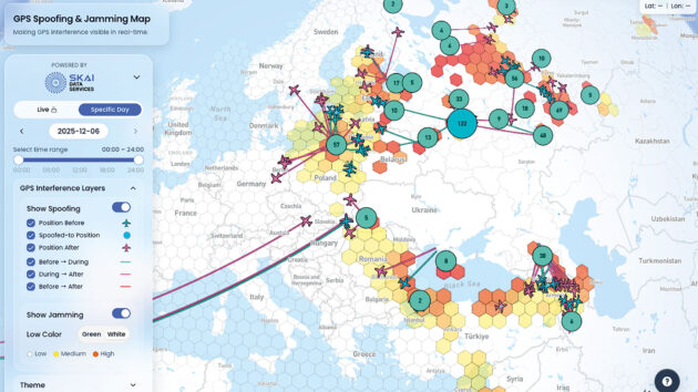
The website gpswise.aero shows a worldwide map where GPS spoofing and jamming has been detected by civil aircraft. Photo: gpswise.aero
Jamming the jammers
Faking GPS signals isn’t technically hard, Faragher explains: the genuine GPS signal of 50W coming from satellites 20,000km away is so small that a transmitter on the ground pushing out just a couple of watts can overpower it locally and create a bubble of false or distorted positioning.
“There are many ways to interfere with GPS, and the closest thing we have to a reliable countermeasure is a special type of antenna called a CRPA (Controlled Reception Pattern Antenna), which is roughly the size of a dinner plate; it’s heavy and expensive,” he notes.
CRPA uses multiple antenna elements plus digital beam-steering electronics and signal-processing hardware to sense the direction incoming signals are coming from and filter out any arriving from suspicious or impossible angles. They are one of the few practical defences.
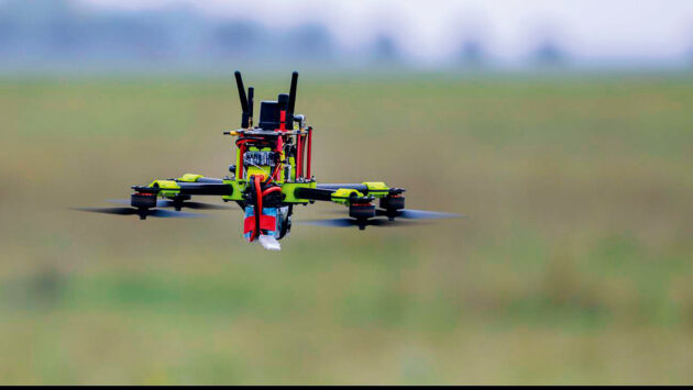
A GPS jamming drone being tested by German authorities as a defence against incursion around airports by other ‘unfriendly’ drones. Photo: Jan Woitas/dpa/Alamy
The technology is tightly linked to defence navigation, so US-made systems are treated as controlled items under International Traffic in Arms Regulations (ITAR). However, lower-end anti-jam or GNSS ‘interference-resistant’ devices are being developed that sit outside ITAR rules, though they are substantially more expensive than regular GPS antennas at roughly £1,100-£1,200.
“But it is more open, and we will be seeing more of these on airlines in the future and big maritime vessels because it is one of the lines of defence,” says Faragher.
Alternative systems are also being reintroduced, most notably Loran. The system dates back to the early 1940s and used low-frequency radio transmitters on land to give position fixes based on timing differences between stations. GPS killed off Loran, and it was shut down in the US and UK over a decade ago, but its resistance to jamming has kindled into life a new-generation high-accuracy enhanced system, or eLoran.

Finns Niklas and Johanna Wärnhjelm sail the Baltic and consider it to still be very safe. Photo: Niklas & Johanna Wärnhjelm
It is considered so vital that, in November 2025, the UK government announced it was allocating £71 million of a £155 million resilience funding package to the development of a national eLoran programme, and £13 million to a GNSS interference-monitoring system. According to Faragher: “eLoran is already in use in South Korea and China, and some other countries have had it as an alternative for a while, and we are looking at rebuilding our capabilities.”
There are other systems that can overcome GPS fragility too, such as Radar Terrain-Referencing, where a vessel’s radar image is automatically compared to a digital chart or coastline database to confirm the vessel’s position. Some modern radars can overlay the radar picture directly onto an ENC chart in ECDIS.
And of course there is “dead reckoning and figuring out where you are the old-fashioned way,” notes Faragher.

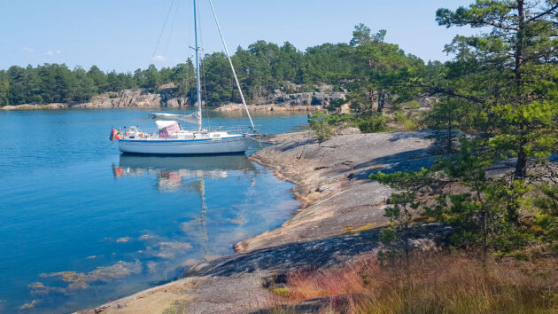
The rocky coastline of islets and islands in the western Baltic’s Stockholm Archipelago is a bucket list destination for many for sailors. Photo: Light-Studio/Shutterstock
“But the challenges are these integrated systems you can’t manually fix, such as your satcoms; those issues remain,” he says.
“Various people are putting out guidance on what mariners can do, and our report [the Royal Institute of Navigation is due to issue a report at the end of 2025] will include a guidance document on what to do and how to prepare and recover. For example, it is very important to fully reboot your GPS receiver if it has been exposed to spoofing,” he says, explaining that you can’t assume anything it has cached is trustworthy.
“We would emphasise the aspect of being very conscious of which technologies are used in your equipment and replacing them or very carefully assessing using these online maps to be confident you are not going into an affected area,” he says.

Photo: Johner Images/Alamy
Things are not as they seem
To return to the experience of Anke and Gerd Schekahn, the region around Kaliningrad continues to be highly unstable. Kaliningrad is not connected to mainland Russia, but as a strategic enclave on the coast it is home to Russia’s Baltic Fleet, air-defence systems, electronic warfare units and (reportedly) nuclear missiles.
Russia regards it as a forward military base and a pressure point where they could cut or squeeze supply chains to NATO’s Baltic states. Aggression has been spilling out to sea from this area.
Friederich Haas is managing director of AKE Skabe, a risk, security, and crisis-management consultancy.
He served in the German Air Force in the 1990s then did Eastern European studies with law, history and politics at the very time that, he says: “history was unfolding in front of our eyes in Poland, Russia and Ukraine.”
German couple Gerd and Anke Schekahn were frightened by their close encounter with a Russian submarine and avoided the waters around the Russian enclave of Kaliningrad on their return passage across the Baltic. Photo: Gerd & Anjke Schekah
Today, AKE Skabe works with companies, NGOs and media operating in hostile environments. “There are not many points where I would agree with Mr Putin, but he’s right that we have been in a different war since the mid-2010s. Since the war in Crimea and the Donbas, hybrid warfare has been going on,” Haas says.
“The Nord Stream [pipeline explosion in 2022] has raised some questions regarding Ukraine but for a long time Russia was checking out how they would control the Baltic Sea. Today, with drones in the battlefield you cannot really hide anywhere, but at sea there are still some quite nice places to hide.
“The Russians have bought ships with sonars and try to understand who is coming along based on the special sound every ship makes, so somewhere in the deep sea you put an underwater drone and when the sound signature comes along you give the drone the command and target it.”
Gerd Schekahn. Photo: Gerd & Anjke Schekahn
The Russian ‘ghost ship’ fleet also poses risks. “The ‘shadow’ fleet was created because of all the sanctions,” Haas says. “They bought and hired a lot of ships – we are definitely talking about more than 100 – uninsured, but with crews and owners paid nicely, and they bring oil and other goods in. They switch off the normal ID systems so you have to be aware, for example on foggy days, that there are many more vessels out there than you think.”
He cites the example of a German Navy ship that approached a Russian scientific vessel only to find people on board who were obviously armed. “A civil ship might be a covert operation by Russian special forces.
Gerd and Anke Schekahn were sailing from northern Poland to Estonia when shadowed by a Russian submarine. Photo: Gerd & Anjke Schekah
“When you sail near military ships you will respect them, but you might not know the ship anchoring out there has Russian special forces on board until you come close to them and they show you their weapons. And you might disturb people who don’t want any witnesses. There is growing uncertainty about what is going on,” he says.
“In the past, you could sail from Rostock to Riga without a problem, but now if you cross some waters the Russians claim to be theirs it could be difficult. You might get into territories you don’t mean to get into and it’s simply a risk.
“You could be arrested on a pretext and find yourself in a Russian prison when you haven’t done anything. We have seen that in the past in geopolitical conflicts where they arrest citizens who haven’t done anything, take them hostage and create a narrative.”
This applies to other areas around the world as well. Haas’s advice is: “Have a security plan of how you are going to handle certain situations and make your crew aware of it. Make sure they know what to do. With clients we do a little role play, a table top exercise. It’s like the training you would do for crossing the Atlantic, so that in the real situation you react by instinct.
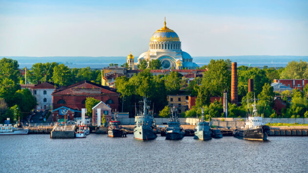
The Russian Naval Cathedral of Saint Nicholas on Kotlin Island in the approaches to St Petersburg in the eastern Baltic. Photo: Linda Steward/Getty
“So you could practice a type of drill where everyone knows what their role is, because a Russian or a NATO patrol boat crew can also be very nervous and may be wondering if this is really a civilian [yacht] or a Russian boat undercover.
“Do we have the passports in one place so we don’t have to search around for them? How do we handle being checked or [rummaged]? How to de-escalate their nervousness, avoid making any sudden, quick movements and remain cool?
“You have to do some careful planning and sit down and analyse the risk. We have to respect the political risks just like we would the weather or avoiding a storm.”
Article continues below…

How to go cruising in the Baltic this winter
Sailing in the Baltic is increasingly popular, and for all the right reasons: beautiful cruising grounds, lovely weather, interesting history…
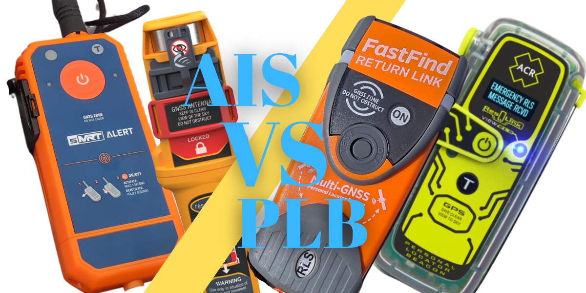
PLB vs AIS Beacon – What’s the difference and which one will save you?
PLB vs AIS Beacon – Which One’s Going to Save You What’s the best beacon or PLB for me? Let…
Yachts as suspects
It’s worth remembering, Haas says, there are good reasons to suspect yachts and yacht crews too. The investigative news site Der Spiegel reported on a theory that a chartered 50ft Bavaria sailing yacht was used to carry explosives in the Nord Stream pipeline explosion.
“Yachts can be stolen to be used in crimes. In the Balkans there are organised crime groups from Montenegro involved in human trafficking and cigarette smuggling to Italy,” he points out. Yachts are also an increasingly common means of importing drugs from South America to Europe. They can make ideal platforms for covert surveillance, even sabotage.
With all the military activity, attention on undersea cables and the chance of navigation or communication problems, sailing in the Baltic demands a bit more care.

‘It felt eerie to know that we were being watched’. Photo: Gerd & Anjke Schekahn
However, the long summer days and short nights make keeping a visual confirmation of your whereabouts usually straightforward. Plotting an estimated position on paper charts every couple of hours is a good habit practised by many Baltic cruisers.
You don’t need to stay away, everyone agrees, but take the same care you would use in any region that carries extra risk: plan your route well; keep your eyes open; and be prepared to adjust your plans if circumstances shift.
Check your position
Finnish sailors Johanna and Niklas Wärnhjelm see Russian activity and GPS interference as an issue to know about, but it is not something that has ever caused them problems.
The couple base their Grand Soleil 40 in Espoo, southern Finland, just over 200km from the Russian border, and have sailed widely to Poland, Lithuania, Latvia, Germany, Norway and Sweden to Denmark.
They say they’ve read about low-flying Russian helicopters, but have never experienced any (the Finnish news site Ilta Sanomat has footage taken by a yacht crew this July of a Russian Kamov Ka-27 Navy helicopter flying very low, and apparently intentionally, around the yacht).
As for GPS interference: “We’ve seen our friends writing about their GPS plotter showing their boat miles away. However, when we leave harbour at the beginning of the season, we always drive very close to one mark just to check,” says Niklas.
‘You need to understand thoroughly how your own safety of life systems work, as there are man overboard and PLB devices based entirely on GPS receivers’ – Ramsey Faragher, RIN president. Photo: Gerd & Anjke Schekahn
Johanna says they take the warnings about hazard area 177 seriously. Area 177 is a large triangular-shaped military danger zone off the coast of Kaliningrad that is regularly activated for Russian missile tests, live-fire exercises or other military operations. When they planned to sail from Klaipeda in Lithuania to Gdansk in Poland, they sought advice.
“Everybody said don’t go in, not even a bit,” says Niklas. They passed through the area in daylight, tacking to stay 35 miles off the coast, but they “would never sail there at night”.
They see this as “a localised problem,” and Niklas adds: “You have to remember we have been living with [Russians] for several decades so we maybe have in our backgrounds been aware of them all the time.” Nevertheless, they consider sailing in the Baltic to be very safe.
A reliable distress system
For yachtsmen, a modern 406MHz EPIRB is still one of the most dependable pieces of safety gear you can carry. Unlike GPS-dependent systems that can be confused by spoofing or knocked out by jamming, a 406 beacon sends its distress alert on a protected, internationally monitored frequency that cannot be blocked in the same way.
Even if the GPS inside the EPIRB can’t get a fix, the signal still reaches the rescue satellites and allows them to locate you through methods like Doppler tracking and 121.5MHz homing.

Gas leaking from the Nord Stream 2 gas pipeline in the Baltic Sea in September 2022. Photo: Swedish Coast Guard/Getty
So if everything else were to fail or signals were distorted, a 406 EPIRB still sends a distress alert. That signal is detected by the orbiting Cospas-Sarsat satellite network, which passes it to a local terminal on the ground, then to a Mission Control Centre which identifies the appropriate Maritime Rescue Coordination Centre, then hands over the alert for action.
To be clear, most personal locator beacons and AIS man overboard devices that crew can carry on their person do not use the Cospas-Sarsat and can be compromised by an unclean GNSS position.
To check recent and historical incidents of interference see GPSwise.aero and gpsjam.org
 If you enjoyed this….
Yachting World is the world’s leading magazine for bluewater cruisers and offshore sailors. Every month we have inspirational adventures and practical features to help you realise your sailing dreams.Build your knowledge with a subscription delivered to your door. See our latest offers and save at least 30% off the cover price.
Note: We may earn a commission when you buy through links on our site, at no extra cost to you. This doesn’t affect our editorial independence.