



A testing Indian Ocean passage rewards Kate Ashe-Leonard with two incredibly beautiful cruising destinations on earth: Maldives and Chagos
Katabatic winds tumble down Phuket’s hillside, sending marbled streaks across the boat-scattered bay. Our anchor comes up with a thud – like a full stop after 18 months in south-east Asia. My arms feel heavy as I unzip our sail bag; we’ve been flat out preparing our Catana 47 Polaris for the months of remote cruising ahead, but first we’ll sail our longest leg of the Indian Ocean, more than 1,500 miles to the Maldives.
Glints of sunlight peek over the Thai island, illuminating the headland and its usually crowded dinghy dock jutting out from the rocks, now deserted.
It’s early February, and sailors have been leaving for weeks to head west. Most will run the Red Sea gauntlet, but we’re taking the long way round, via South Africa and across the South Atlantic.
Our route from Asia to South Africa spans more than 6,000 nautical miles and two hemispheres. Unlike the Pacific or Atlantic, the Indian Ocean offers no simple downwind crossing; voyages must be timed around the monsoon cycle, trade winds and cyclone seasons.
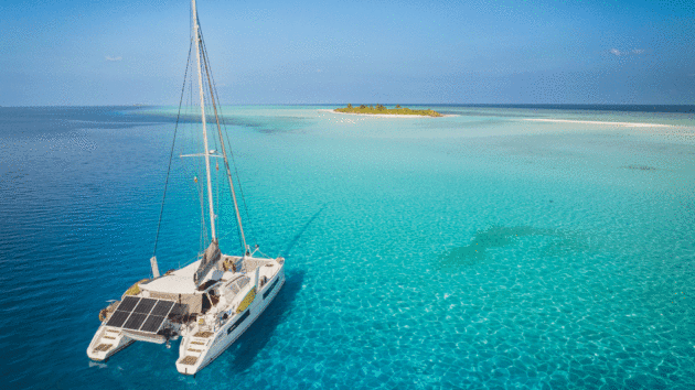
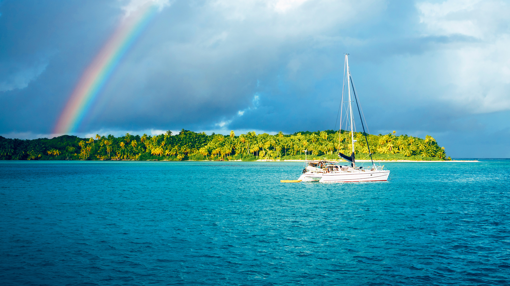
Polaris anchored among the coral in the Maldives. Photo: Kate Ashe Leonard & James Hooper
The seasonal reversal of the monsoon often pits wind against current, creating the chaotic seas the Indian Ocean is notorious for, potentially rougher than anything we’ve yet encountered on our circumnavigation.
In the northern hemisphere, the window to head westbound opens with the north-east monsoon from November to April, before the onset of the south-west monsoon. January and February are best, when the north-easterlies are strongest and the Bay of Bengal is least active for tropical cyclones.
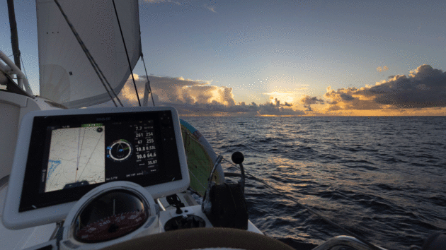
Good sailing conditions at sunset on passage in the Indian Ocean. Photo: Kate Ashe Leonard & James Hooper
In the southern hemisphere, cyclone season also runs between November to April. From May, as the seasons change and the Intertropical Convergence Zone migrates north, the south-east trade winds begin to re-establish themselves, providing weather windows for westbound passages. Most yachts aim to reach South Africa and out of the danger zone before the next cyclone season.
Our plan is to cross the equator in late April for the Maldives’ southernmost atoll. As the monsoons transition, thunderstorms and westerlies render many Maldivian anchorages untenable by May. Instead, we’ll continue 300 miles south to Chagos, where the weather is more settled, spending a month exploring before riding the south-east trades along the rhumb line to the Seychelles.
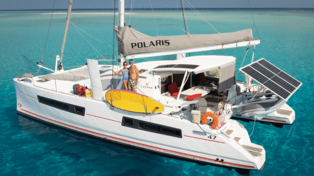
Polaris is a Catana 47 performance cruising catamaran with carbon-reinforced daggerboards. Photo: Kate Ashe Leonard & James Hooper
Into the Indian
Phuket shrinks away as we meander through red and yellow fishing buoys. In the distance, yachts sail on port tack, signalling unforecast south-west winds. We hoist full mainsail and genoa hoping the wind will shift north-east as we pull further away from land.
Rather than taking the more direct Sombrero channel, we opt for the stronger winds and favourable current forecast south of Great Nicobar island. The trade-off is sailing closer to the mouth of the Malacca Strait, one of the busiest shipping arteries in the world, and Sumatra, an island notorious for the thunderstorms which hang persistently over it.
The sea breaks in long, vertical bands, like waves crashing on a reef. We’re reefing the sails, bewildered by this confused water dancing around our hulls; but it turns out to be current that propels us by an extra two knots until we’re halfway to Great Nicobar as night falls.
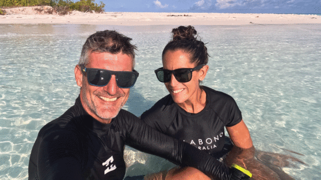
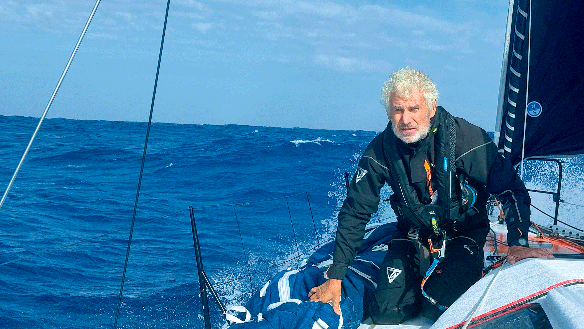
Kate Ashe-Leonard and Jim Hooper have sailed more than 37,000 miles in eight years on Polaris. Photo: Kate Ashe Leonard & James Hooper
By 0200 it’s like trying to sail through glue, the current is now against us and the boat bombarded by waves. Defeated, we turn an engine on to keep some forward momentum. Battering rain squalls – one stretching for 10 miles – complicate our progress further and we divert around them for hours. Lightning strobes the sky as we inch slowly westward.
The rowdy current dissipates and the north-east wind fills in once we clear Sumatra and Great Nicobar. Sailing at 10 knots on a broad reach under main and Code 0, at last we’ve entered the Indian Ocean proper. The stars are blanketed by clouds but the gushing white noise of our speed is soothing. Bioluminescence lights our wake and I sit, tea in hand, watching as morning floods the sky.
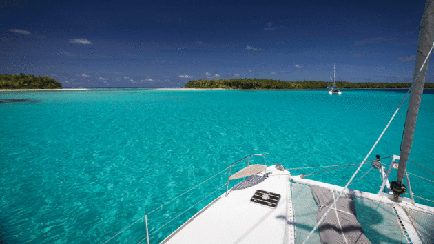
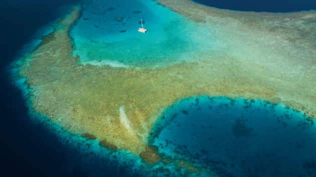
The anchorage at Île Fouquet in the Salomon Atoll of the Chagos Archipelago is popular with the relatively few cruisers who venture there. Photo: Kate Ashe Leonard & James Hooper
Sri Lankan test
As we approach the southern tip of Sri Lanka we again set two reefs in the mainsail and genoa. The wind, squeezed down the coast, doubles in strength while tremendous swells strike Polaris from several directions. The movement makes cooking impossible while the repetitive thundering on the hulls means we get no rest.
Our AIS lights up with targets. We opt to go south of the Sri Lankan shipping lanes and it’s the right call, avoiding the fishing traffic and gustier conditions north of the lanes.
A calming wind shadow slows the boat as we pass beneath the Sri Lankan landmass, and for a few hours, we live normally, devouring freshly prepared food and taking leisurely naps.
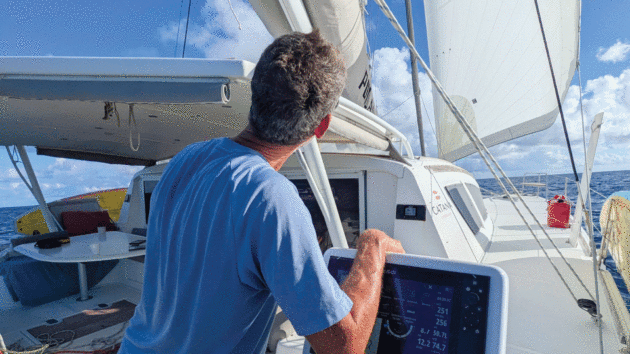
Jim keeping an eye on the trim and horizon while on passage. Weather can change quickly in the Indian Ocean. Photo: Kate Ashe Leonard & James Hooper
But it’s short-lived as, like a monster that’s been holding its breath, the wind exhales again, intensifying as we sail west. Funnelling down from India, the seas stack up and 3-4m walls of water pound the boat. After washing diagonally over our bows, one crashes onto the coachroof, pelts the mainsail and pools in the cockpit. Polaris races along at 12 knots.
At last the swells reach a tense agreement, working together in regular intervals midway between Sri Lanka and the Maldives. The wind relaxes too, from a sporty 25 knots on the beam down to 15 before fading to nothing. After nine and a half days we are gliding through the sapphire still waters of Uligan, the Maldives’s northernmost atoll.
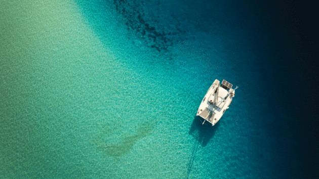
Polaris anchored at Laamu Atoll. Photo: Kate Ashe Leonard & James Hooper
Maldives atolls
The lagoon erupts with spinner dolphins that guide us to the town anchorage. From the bow, I lower our anchor and watch a couple of stingrays slide across the sand.
Exhausted, we welcome the six officials who come aboard to clear us in. Polaris finally rests.
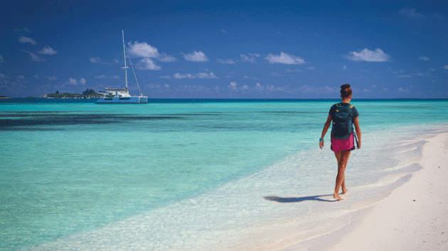
Ari Atoll west of Malé in the Maldives is famous for its pristine, white-sand beaches. Photo: Kate Ashe Leonard & James Hooper
A vertical string of 26 coral atolls containing 1,192 islands, the Maldives stretches across nearly 500 miles and sits on one of the world’s largest reef systems. Megafauna including manta rays, sharks and whale sharks congregate, attracted to the ocean currents that converge near the equator.
It is a devout Islamic country, but mainstream tourists are largely insulated from restrictions – visiting only private resort islands, away from local villages. As sailors, however, our experience was very different.
A 90-day cruising visa gave us the freedom to sail the entire archipelago independently. But that freedom comes at a price: with mandatory agent, anchoring and vessel-tracking fees, the Maldives is one of the most expensive cruising destinations we’ve visited.
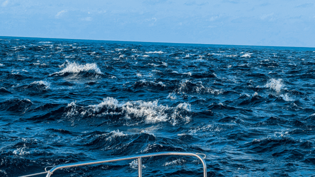
Bands of current churn the water near the mouth of the Malacca Strait. Photo: Kate Ashe Leonard & James Hooper
After passing immaculate coral-brick houses with neat front gardens, we meet our agent who treats us to a typical Maldivian breakfast of shredded tuna, grated coconut and red onions wrapped in roshi before handing over our stamped passports.
Dozens of manta rays are known to congregate just 18 miles away in a tiny disc-shaped atoll called Kelaa. We sail there gently in less than 10 knots of north-easterly wind, our muscles still recovering from the long, rough passage.
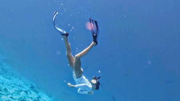
Kate freediving at Kelaa. Photo: Kate Ashe Leonard & James Hooper
Like anywhere with coral reefs, charts cannot be relied upon – as we arrive, we scan the water for coral heads and pale, shallow water. Aided by satellite images, we find a sandy spot to anchor between the bommies. Then they appear. Graceful shadows advance through the clear waters around Polaris: a troupe of 15 manta rays; forming a daisy chain parade for hours.
Following vertical spears of sunlight, we freedive coral walls that drop away into navy blue where sharks and rays patrol the depths. The lagoons of the northern Maldives are glassy in these light winds with visibility exceeding 20m.
In the passes, where the lagoon water spills out into the ocean, an underwater spectacle takes place; frenzied baitfish, huge Napoleon wrasse and giant trevally drift among schools of needlefish and hunting barracuda.
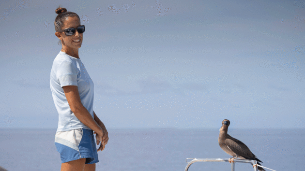
Brown booby perches on Polaris at Salomon. Photo: Kate Ashe Leonard & James Hooper
The sandbar of Kagimar lagoon beckons us; as kiteboarders we’re unable to resist the perfect 15-knot winds forecast. With a north-setting current offshore, we’ll remain within the shelter of the atolls as we sail south for the 150 miles there.
We plot a course around coral bommies and islets, and the passage is swift on a broad reach. Polaris’s hulls slice the water, and we pass lights from buildings that seem to float in the darkness.
In Goidhoo Atoll the call to prayer echoes as we set our anchor. We find three inhabited islands along its north-eastern edge and several shifting sandbars. It’s Ramadan still, and the villages here move slowly; local people are fasting, conserving energy until the brutal heat of the day subsides. Come evening, simple grocery shops and a farm that grows mango, papaya and aubergine reopen, and we replenish our food stores.
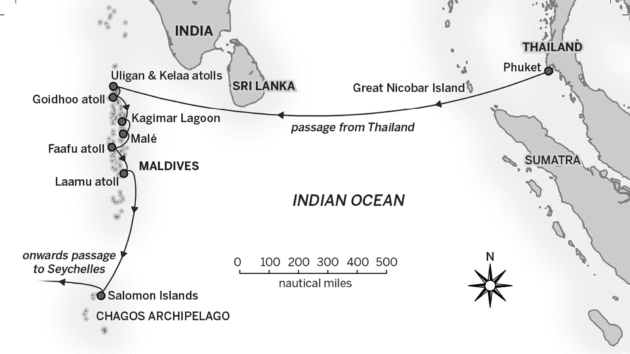
Photo: Richard Thomson
The wake kicked up by ferries and resort seaplanes makes anchoring uncomfortable once we reach the archipelago’s middle atolls. This is the tourism epicentre; where the capital, Malé, and largest international airport are located. Beneath the surface, the contrast is even starker; the reefs we snorkel are bone white or smothered in sediment and algae.
Across parts of the Maldives, mass bleaching from rising sea temperatures has reduced coral cover by 80%. Localised damage compounds this loss: channels bulldozed through reefs to create lagoon access, and land reclamation for resort development, have also devastated the marine ecosystem. Like the ruins of a once-thriving ancient city, this underwater moonscape is largely devoid of life.
In pursuit of healthier reefs, we rush on, favouring the Maldives’s less visited outlying islands. Far from the crowds, in Faafu Atoll, we stop at a tiny island surrounded by coral. To our relief, an old fisherman’s hut is the only trace of human activity – although we’ve only seen a few, there are up to 100 abandoned resorts across the country, each sitting on a private island, left crumbling into the sea.
Peaceful sailing in light airs takes us closer to the equator. The blur of sea and sky is separated every so often by turtles breaking the surface for air in Laamu Atoll. Anchored upon a shallow ledge in fine white sand, we explore the depths where the coral reef crackles reassuringly with life once again.
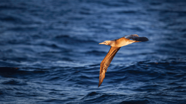
Booby in flight at sunset. Photo: Kate Ashe Leonard & James Hooper
Across the equator
The seasons are shifting; it’s mid-April and the wind starts blowing out of the west. Equatorial squalls bring high winds and thunderstorms for days. Local boats take refuge in town anchorages and we make short day-hops, nestling in among them overnight on our journey through these southernmost atolls.
Relative calm arrives and we point high to counter the now east-setting current.
Sailing close-hauled from Huvadhu to Addu Atoll, 50 miles south, we cross the equator, hammered by rain as lightning bolts decorate the sky. We squeeze in between a cluster of boats all preparing to depart. Those taking a direct route to the Seychelles face a long wait in deteriorating weather for the south-easterly trades to reach this latitude.
With every locker full of supplies, we set our sails for Chagos, one of the least visited, uninhabited archipelagos on earth. With a permit to stay for up to 28 days it’ll be about five weeks until we see civilisation again.
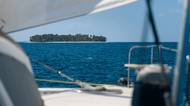
Sailing between the atolls in the Maldives. Photo: Kate Ashe Leonard & James Hooper
The holy grail of remote cruising, the Chagos archipelago is isolated in the middle of the Indian Ocean. Unlike the Maldives, this chain of coral atolls is protected from significant human interference as one of the largest marine reserves on the planet. Seabird populations including boobies, terns, noddies and frigatebirds have flourished, and the coral reefs are among the healthiest in the world.
Having been used for decades by sailors crossing the Indian Ocean, Chagos has become more difficult to visit in recent years. Entry requires a permit issued on a case-by-case basis, adherence to strict regulations and substantial fees. which has kept visitor numbers exceptionally low. This year only about 19 boats will visit.
We dodge towering thunderstorms on our passage to Chagos’s Salomon islands, which is peppered with rain squalls that ease the oppressive humidity. Sailing close hauled in south-easterly and then south-westerly winds into a one knot current, we end up motoring when the wind dies off entirely.
Article continues below…
Island-hopping across the vast Indian Ocean
There’s a saying among sailors that plans are only ever made in the sand at low tide. Sailing the world…
Racing around the world via the great capes: ‘The feel-good factor you get from mastering complex skills is a big driver’
Four days from the Cape of Good Hope it’s still proving impossible to identify a safe route past the cape…
Chequered history
A palm-topped silhouette comes into focus as we approach the islands. With 11 islets, this atoll is less than five miles long and just over three miles wide. Spinner dolphins hunt off our port side and a young brown booby settles on the starboard bow. Our hulls send ripples across the interior as we head towards our anchorage. Here nine boats will shelter with us before continuing west when the trade winds arrive.
In spite of its remote location, Chagos has long been dominated by geopolitics. Administered by France until 1814, Chagos later became a dependency of Mauritius under British colonial rule.
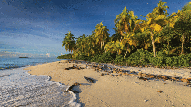
Archetypal palm-fringed beach on Fouquet Island in the Chagos Archipelago. Photo: Kate Ashe Leonard & James Hooper
Three years before Mauritian independence in 1968, the UK separated the islands to form the British Indian Ocean Territory and establish a joint UK-US military base on Diego Garcia. The Chagossian people, descendants of plantation workers originally brought here to farm copra in the late 1700s, were forcibly removed to Mauritius, the Seychelles and later the UK.
Today, sovereignty remains contested and the future management of the islands – and the protection that has kept them so wild – remains uncertain.
We rise with the sun, becoming attuned to the rhythm of the atoll here: at low tide we wade through shallow rock pools that hug the shore in the morning’s changing light, watching as crabs and camouflaged moray eels scuttle past nurseries of juvenile blacktip sharks.
We walk under the shade of palms bent over decades by the winds, which reveal the complex root systems holding this place together. Birdsong and the rasping calls of boobies in nests built low to the ground are the only sounds to be heard above the crashing ocean.
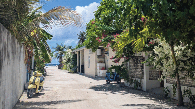
White sand-covered village street in Goidhoo Atoll. Photo: Kate Ashe Leonard & James Hooper
At high tide, we paddleboard over a reef that glows honey gold, emerald green and lavender, then mask up and freedive through fields of branching table corals. Centuries-old brain corals unfold before us as we follow underwater corridors shaped by hills of staghorn corals and sea fans, swaying alongside anemones and peeking endemic clownfish. Rays and blacktip sharks dash around while a nurse shark rests on the seabed.
Ashore, on the island of Boddam, in the atoll’s southwest corner, poignant remnants of an old Chagossian village lie tangled amidst an unfettered palm forest. Graves, a church and a school remind us of the lives spent here. The current administration makes its presence felt too – military jets from Diego Garcia screech overhead and we’re visited by customs officials to check our permits.
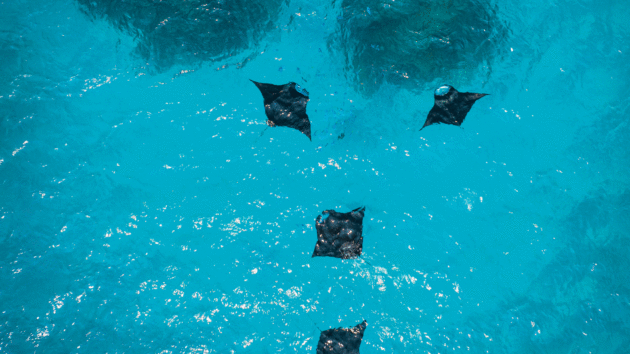
Manta rays at Kelaa Atoll in the Maldives. Photo: Kate Ashe Leonard & James Hooper
Catching the trades
The yachts in our anchorage turn to face south-east at the end of May: the trade winds are here. But fresh food is running low so we join two other dinghies heading outside the atoll to try our luck fishing before setting off. After trolling a line, it’s only seconds before our reel screams, but the head of the tuna is all that remains on our hook. In the water below, four whitetip sharks circle, hungry for more.
We relocate, but the next time something snatches our lure entirely. On our third attempt we land a Wahoo, its blue and silver stripes contorting as we pull it in.
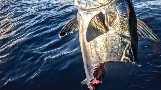
Shark got to tuna catch first. Photo: Kate Ashe Leonard & James Hooper
On our final night I sit at the water’s edge as the palm forest glimmers red in the day’s fading light. But there’s a heaviness about leaving. As coral reefs and wild habitats continue to disappear across the world, I wonder whether those following in our wake will find the outer Maldives and Chagos as intact and wonderfully alive as we did.
 If you enjoyed this….
Yachting World is the world’s leading magazine for bluewater cruisers and offshore sailors. Every month we have inspirational adventures and practical features to help you realise your sailing dreams.Build your knowledge with a subscription delivered to your door. See our latest offers and save at least 30% off the cover price.
Note: We may earn a commission when you buy through links on our site, at no extra cost to you. This doesn’t affect our editorial independence.