
From set-up tips to using GPS, NMEA and AIS, pro sailor Pip Hare explains why your iPad can be one of your most valuable bits of kit at sea

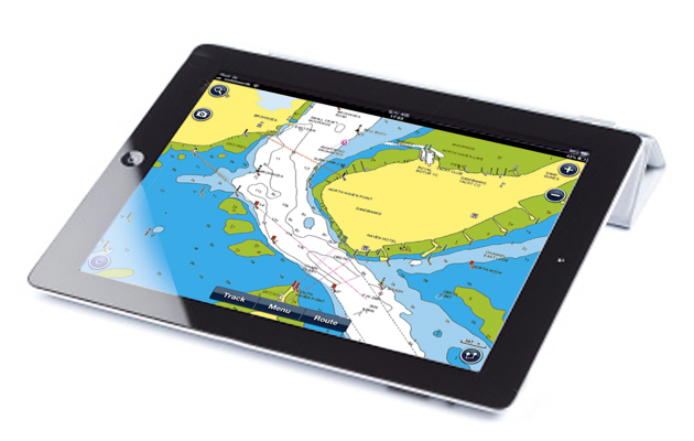
These days it’s rare for me not to use a tablet as part of my navigation equipment. The fact I can take my tablet with me anywhere in the world and have access to charts on an interface I am familiar with is a great bonus, as well as the ability to comprehensively plan passages from home.
There are, of course, limitations and pitfalls to the use of tablets but, so long as they are understood, these devices can be used to great effect. Here’s my quick list of tips and hints to make the most out of your tablet and stay safe:
Set up tips
- Rotation lock: Turn this on to stop the screen from reorienting when you pick the tablet up or when the boat heels.
- Privacy settings: Ensure location services are enabled for your chosen app. Select ‘allow only when app is in use’ to save battery time but be aware that if the app is closed then it may take a while to re-establish a position when it’s reopened.
- Screen lock: Set your screen lock time to its maximum setting or never. This has implications on battery life but is particularly important if there is a code set to unlock the screen. If using a tablet for navigation regularly it’s better to remove security codes so any member of the crew can access it.
- Battery life: One of the downsides of using a tablet for navigation is its relatively short battery life. Battery life can be prolonged by reducing display brightness, turning off WiFi/Bluetooth connections and only recording the vessel track if it’s essential to navigation. If you use it a lot on deck then invest in a waterproof USB charging point close to where the tablet is mounted so it can be plugged in for the majority of time. Make sure you take plenty of spare charging cables as the ends are susceptible to corrosion and regularly fail.
- Screen brightness: Remember to dim the screen as the natural light fades, this will save battery life and night vision. To maximise night vision, turn the tablet face down or cover it when not needed.
GPS and NMEA
When choosing a tablet for navigation ensure it has an internal GPS – if working with an iPad you’ll need to select one with 3/4G capabilities for this. Some Android tablets have GPS with their WiFi-only tablets as well as cellular ones.
The GPS position provided by the tablet will not be as accurate as that of a plotter using an external antenna and should not be solely relied upon. Always back up your position using visual checks and never use the GPS in your tablet as your sole means of fixing a position – if the tablet is your primary plotter then use an external GPS feed to improve accuracy.
Most navigation apps are now capable of taking an NMEA data feed via WiFi. This is a great way of providing reliable position data, overlaying AIS information and enabling the tablet to be used as an extra instrument screen from anywhere on the boat. Not all apps can take multiple NMEA feeds so think about what it is you most want your tablet to do and then choose the right app for you.
Article continues below…
iPad navigation apps tested: Pip Hare reviews 7 chartplotting apps
The development of navigation apps has now advanced to the stage where tablets are being used regularly by many sailors…

Why paper charts still have a place alongside iPad and electronic navigation
When you open up any electronic navigation program you usually see a disclaimer telling you not to rely on its…
Using AIS
This is an excellent addition to most navigation apps and can provide a cost-effective solution to viewing AIS data on deck for anyone without a plotter. But do your research as every app offers different levels of AIS functionality and it’s vital you understand the limitations of each.
You need to know what data source the app uses for AIS: most will take this information from an NMEA data feed over WiFi (this will either need to be broadcast from a wifi-enabled device or via a standalone NMEA WiFi transmitter). AIS data in this form will be up to date and as current as AIS data can be.
Some apps use AIS information from the internet – this would be streamed over a cellular connection to your tablet using large shore stations as the source. This data can be detailed and accurate and if you have no AIS device on board it can provide an extra level of situational awareness. However, this data should never be considered as current and should never be relied on for collision avoidance. It will also only be available while your vessel is in GSM range.
Also check how the AIS information is displayed and what data is available for each app as there is no standard format – some don’t provide a CPA (closest point of approach), others don’t provide a vessel name. If using AIS MOB devices, test your device while the app is in use to ensure you know what symbol is displayed in the event of activation. The standard symbol is a red circle with a red X inside, but some apps may display the device as a boat.
Easy updates
One of the great things about navigation apps is the versatility of information that can be displayed and the ease with which charts can be updated. Most apps will notify when a new chart update is available so make a point of regularly going online to check each of the downloaded chart areas. These updates are included in yearly subscriptions, so after your initial download you’ll need to pay again annually for further updates.
Use the mapping layers to gain more information for planning or making landfall in new places. In particular the satellite layers are useful for identifying landmarks and visualising what the coast will actually look like. When researching new places, I’ll take screenshots of the satellite images at key positions then store them in the photos section of my tablet as my own bespoke pilot book.
First published in the March 2020 edition of Yachting World.