
Inaccuracies exists on paper charts too, but there is something about the margin of error we give iPad and electronic charts that is worrying. That's why I carry both

When you open up any electronic navigation program you usually see a disclaimer telling you not to rely on its accuracy. ‘All charts and maps are for reference purpose only. You assume all responsibility for their use and for the use of this software’, says the waiver on the Navionics charts.
A few years ago when I first wrote on my blog about using an iPad as a portable chartplotter I got warnings from several readers about the inaccuracy of the charts. One pointed out that the Navionics iPad charts showed a fictitious island off the Caribbean island of Redonda, and elsewhere a cardinal mark that changed from a north to a south cardinal at different zoom levels.
Read our test review of iPad navigation charts here.
Other anomalies exist, but they are not unique to mobile charts. Most of these errors are not platform-specific and can be found on the charts for full-scale standalone GPS chartplotters, from which mobile charting derived. I was reminded of this in February when we anchored in a bay approximately 300m offshore yet the yacht’s chartplotter, and my iPad charts, put us well up the hill to the west.
Inaccuracies also exist on paper charts, perhaps more often that we realise. Some Pacific islands surveyed long ago are said to be several miles away from their charted position. GPS-derived positions often are of much higher accuracy than the positions for charted data. And even apparently up to date charts can lag behind the times.
I wonder if the difference with using paper charts is the margin of error we tend to give things. If I’m absolutely honest with myself, I know I navigate more cautiously when plotting a position on a paper chart. Old habits die hard.
I review all the chart features more closely (there’s far greater detail to look at anyway and it’s more interesting) and when I lay off a course I know I look more conscientiously and thoroughly for hazards along its line. I suspect I may be slightly more diligent about checking and double checking transits, shapes and light characteristics. That keeps pilotage skills alive. So I prefer to use a mixture of both.
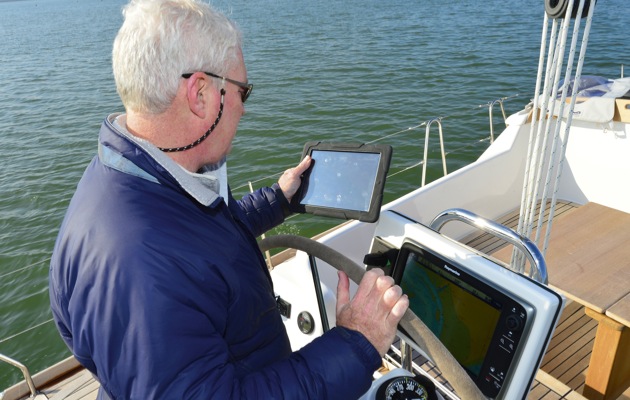
Using a 3G iPad2 and its internal position-fixing system
Paper charts, or electronic raster charts that are facsimiles of them, can be wonderful for exploring the coastline and nosing around little coves and rocky notches of the coast in a dinghy – the detail is all there. And if you are rockhopping along the coast, there is usually more close information on a paper chart or its electronic equivalent and rocks are often easier to spot.
My paper charts, though most are out of date, also have useful margin notes I’ve added at some time or another that I’d never have put on electronic charts. ‘Anchor abeam of the ruined stone wall in 5m’; ‘Can net prawns here at low water’, ‘Place to land dinghy in natural slipway’.
And I love the beautiful engraved views of land and harbour entrances that still adorn some modern UKHO Admiralty charts. They evoke a period of intricate observation.
The perspective was a speciality of the 18th Century hydrographer Alexander Dalrymple, who wrote ‘Essay on Nautical Surveying’ in 1771, was the first hydrographer of the Admiralty and put into practice methods and ideas still used today. (Mind you, he was quite wrongly convinced of the existence of Terra Australis Incognita, an undiscovered continent in the South Pacific.)
The extraordinary accuracy of modern charts do make it harder to remember that they are still basically guides on which to overlay your own observations and add an extra measure of caution.
When I think of hitting the bricks, I always remember the charter company owner who told me that people nearly always claim they hit an uncharted rock. But if he followed the boat’s track back or worked out where it happened, there it was on the charts, plain as day and in exactly the right position. The most common errors are ones we make ourselves, to be filed under ‘eye off the ball’.