
Edit: Feb 2017 - This test is superseded by iNavX review by Pip Hare. We tested the iNavx iPad app as part of a group test of portable chartplotting software. App Free • Charts £46.38 ($69.99) • Vector charts • Navionics cartography •
iNavx iPad app

Edit: Feb 2017 – This test is superseded by iNavX review by Pip Hare.
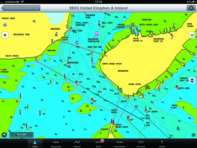
The ability of the iNavx iPad app to read both raster scanned and vector charts makes it versatile. This plotter scores well in the USA where the NOAA charts are raster scans and a popular form of digital navigation. Unlike many apps, this one will read a number of different chart formats as well as provide the ability to overlay GRIB weather files.
If you’re looking for an app that you can integrate and expand in time, this is a good choice, especially as the display allows you to tailor the information displayed.
But in Europe (and for our test), the system uses Navionics charts, which need to be downloaded from www.fugawi.com, which was not as straightforward a process as with some other apps.
We struggled to warm to this system. If you’re going to use Navionics charts, the Navionics app is cheaper, easier and clearer. For a standalone iPad chartplotter, there are simpler and more intuitive systems available.
See reviews of the other iPad apps in our group test
Verdict
While this system may have a place in the US, we struggled to see why you would use this in preference to other plotters in Europe.
Details
: