
World and European Championship-winning professional navigator Tom Cheney takes us through the course for the Rolex Middle Sea Race

This year marks the 44th edition of the Rolex Middle Sea Race, which has now earned its place alongside the Fastnet Race and Sydney Hobart as one of the classic 600-mile offshore races. The 606-nautical mile course, starting and finishing in Malta, takes you on a breathtaking journey around Sicily and through the stunning islands of the eastern Mediterranean.
Navigating what might appear as a straightforward circumnavigation of the largest island in the Mediterranean is, in reality, a challenge. Imposing coastal terrain (including erupting volcanoes), unpredictable currents, fast changing autumnal weather – that can typically vary from zephyr light to strong winds over 24 hours – are a few of the hurdles you’ll need to overcome. Here we walk the course for the Rolex Middle Sea Race.

The course breaks down into legs varying from 25-125 miles.
Start to Strait of Messina
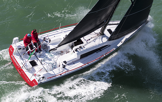
The race begins in Valletta, Malta, with a spectacular start in the Grand Harbour. Cannons marking the start are fired from high medieval battlements that would look quite at home in an episode of Game of Thrones. As well as being a breathtaking sight, this grand scenery plays havoc with the wind, often meaning the initial leg out of the harbour is in very tricky, shifty conditions. Luckily it’s not far to get out into the cleaner breeze outside the harbour.
Gradient wind in the Malta Channel, between Malta and Sicily, tends to be from either the east or west, blowing up or down the Mediterranean between Europe and Africa. This means that the first leg up to the southern tip of Sicily is usually a fetch or a reach. This is a good opportunity to use your Code 0s, flying headsails and staysails if you have them!
The next section of this leg, up the eastern coast of Sicily, is quite often a true beat. Again, the wind tends to wrap around the coast. By the time you make landfall it will probably be early evening, so you also need to look out for tricky land breezes. Mount Etna, which is 3,300m high, also leaves a huge wind shadow – the rule of thumb is to stay at least 18 miles offshore.

Racing past Aeolian Islands of (from left) Filicudi, Salina, Alicudi (closest) and Vulcano (in very background). Photo: Carlo Borlenghi
Messina to Aeolian Islands
The Strait of Messina is definitely one of the most challenging stages of the race. The narrowing terrain produces funnelling wind and currents. Currents in the narrowest part of the Strait, which is less than two miles wide, can be as strong as 5 knots. There are tidal charts available, including a cheap smartphone app, although I’ve found these to be fairly unreliable. If you find yourself fighting current then look for eddies close inshore, initially in the east, and then on the north shore as you round the corner.
Article continues below…
How to win at double-handed racing – 5 top tips from a Fastnet champion
The popularity of double-handed sailing is on the rise. The Rolex Fastnet Race is the perfect case in point –…

How to win the Rolex Fastnet Race: expert navigator’s tips
The 2021 edition of the Rolex Fastnet Race came with an interesting change. The finish line, having always previously been…
The Strait is also a busy shipping lane with a complicated Traffic Separation Scheme. It’s made even more difficult by the fast hydrofoiling ferries that cross back and forth in several places. The sailing instructions usually include a section which governs your obligations regarding this TSS. Keep your wits about you as the traffic moves quickly. You should also monitor VHF Ch10 for Messina VTS.
Once you’re out into the Tyrrhenian Sea, the fleet heads north toward the Aeolian Islands. This leg can is often characterised by challenging and shifty winds around the volcanic Aeolian Islands. Stromboli in particular can cause exaggerated thermal-like conditions when the volcano is active – and you won’t find that on any weather forecasts.
Aeolian Islands to Pantelleria
The final tricky inshore component of the race is often at the island of Favignana, just off the western corner of Sicily.
Here you can experience everything from wind shadows to squalls and thunderstorms. A combination of the LaMMA high resolution weather forecast and your ‘Mk1 eyeball’ are critical here. Keeping an eye on the speed and direction of boats ahead on AIS is another good indicator tool.

Passing the live volcano of Stromboli. Photo: Kurt Arrigo/Rolex
Pantelleria to Lampedusa
Once south of Sicily, you are back into slightly more predictable weather – although predictable does not always mean pleasant. Strong winds and a rough sea state can often feature on these more exposed and remote legs of the race. Make sure your boat is in good shape before you start heading south towards the north African coast.
Lampedusa to Finish
After rounding the final remote island of Lampedusa, turning up towards Malta’s Comino channel will feel like the home stretch.
The Comino channel between Malta and the islands of Comino and Gozo offers a final obstacle for a tired navigator. The channel is less than a mile wide and you need to keep a good look out for the fast moving ferries.
Once through the channel, you only need sail back to Valletta, leaving the fairway mark to starboard. The finish line is in Valletta’s Marsamxett Harbour, located to the north of the Grand Harbour. The entrance is a little narrower than the start, but it is well marked and well lit at night.
 If you enjoyed this….
Yachting World is the world’s leading magazine for bluewater cruisers and offshore sailors. Every month we have inspirational adventures and practical features to help you realise your sailing dreams.Build your knowledge with a subscription delivered to your door. See our latest offers and save at least 30% off the cover price.