
Cut the fat to bare operating efficiency – that’s the motto of today, in business, lifestyle or sport. We are all increasingly overworked and need to streamline wherever possible. The…
£179.00

Cut the fat to bare operating efficiency – that’s the motto of today, in business, lifestyle or sport. We are all increasingly overworked and need to streamline wherever possible. The…

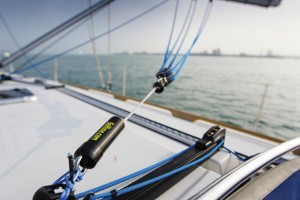
Today’s streamlined and efficient deck layouts use purchase systems led to cam cleats for a number of functions that a decade ago would have been more likely to be led…
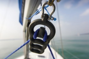
These neat and compact aluminium, low-friction, sheaveless blocks have a multitude of uses. The smallest, weighing just 2g, will take lines of up to 5mm and has a breaking load…

In the face of it this is a great back-up system – a 10ah lithium battery pack/connection hub with ‘intelligent charge electronics’, plus a 20W solar panel and two bright…
Every discerning sailor will carry out some sort of weather routeing before going out on the water. The extent to which we are able to predict weather patterns and assess…

Varta High Optics 3C Flashlight – 9/10 Used: every night of the race for sail trim, sail changes, rig checks and problem solving. This handheld torch allowed me to pick…
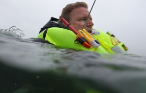
In a safety briefing for the double-handed Transat Jacques Vabre race, a French search and rescue pilot told us just how hard it is for a spotter plane to see…
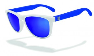
I like sunglasses and have accrued a growing collection of assorted pairs. Rarely do I part with much money for them however, as I see little point when I know…
Sometimes products come along that make you question why no one has thought of them before. And that was definitely my first impression when I got hold of a Seabung…
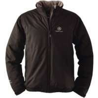
I used these midlayers during the 2015 Fastnet Race, and although it was not a particularly cold event, these were the best piece of kit/clothing I brought with me. I…

How frustrating it would be to have a car with just two gears! Yet most sailors still rely on standard two-speed self-tailing winches for all winching applications. The self-tailing winch…
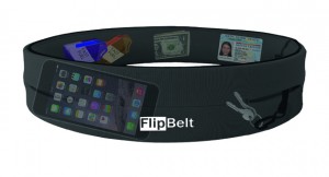
Although designed as a comfortable place for runners to hold their iPod or phone, the Flipbelt is also a useful way to carry money, keys or phone securely in warmer…

Elaine is not the only one to fall for a packaway-style jacket (see her review of the Musto Women’s Evolution Primaloft Jacket). The Henri-Lloyd Halcon jacket became an instant favourite and…
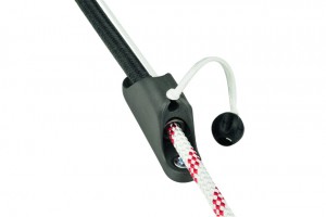
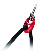
Working on the same principle as the Chinese finger trap, the Cousin Trestec Constrictor 10 is a simple yet effective means of securing relatively highly loaded lines. This principle of…
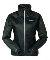
This is my new favourite mid-layer jacket. The Musto Women’s Evolution Primaloft Jacket is warm, but incredibly light. It is filled with PrimaLoft, a patented synthetic microfibre that has almost magic…
There are a number of solutions on the market to help control a gybe and minimise the effects of a crash gybe, but how practical, effective and relevant are they…

There are a number of solutions on the market to help control a gybe and minimise the effects of a crash gybe, but how practical, effective and relevant are they…
There are a number of solutions on the market to help control a gybe and minimise the effects of a crash gybe, but how practical, effective and relevant are they…

EPIRBs When activated, an Emergency Position Indicating Radio Beacon (EPIRB) transmits its details on 406MHZ and, if GPS-enabled, the vessel’s position to within 100m. This signal is relayed by satellite…
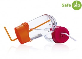
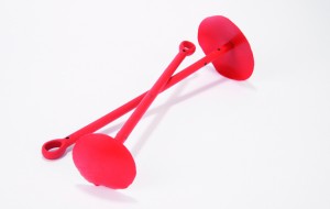
This SafeSip cap allows you to use virtually any drinking vessel without fear of spillage. The UK-made reusable silicone cap stretches over cups, glasses and cans to keep liquids in…