
Sailing weather expert Chris Tibbs is off on a round the world cruise. He explains the options for receiving weather data at sea and reveals what he will be using

When I skippered a yacht in the first Atlantic Rally for Cruisers (ARC) 30 years ago the weather planning information we had after we left Las Palmas was just about zero. Navigation was chiefly via sextant.
But communications and navigation has changed immeasurably since then and with it our choices. During the last Azores and Back race (AZAB) we gybed off the direct route to jump 50 miles north, and took the leg by over seven hours on corrected time. We made that decision purely on weather information received on board via a satellite phone.
Today we are used to getting a huge amount of information from the internet, but this quickly drops off as we head offshore. On any ocean or long offshore passage communication choices are limited to satellite or radio.
However, there are still a lot of choices to be made depending on requirements and budget. It sounds as if it should be simple, but it isn’t – a bit like choosing a boat, we might think we know what we want, but how many people would have made the same decisions at the end of a passage that they did when planning it?
The best place to start is to consider what sort of basic weather information you would like to receive out at sea.
Weather information
At the top of my list are synoptic and forecast weather charts. These have not changed much over the years and give a very good overview of where systems are and where they are going. With some knowledge and practice, wind speeds and direction can be determined, expected weather near fronts, and by identifying air mass, a good estimation of conditions can be made. These charts cover the analysis and forecast for up to 96 hours and sometimes longer.

Forecast charts such as this can be obtained via weatherfax, email or downloaded online
To add more detail and to avoid having to measure isobar spacing and convert to wind speed, GRIB files can be downloaded and overlaid on an electronic chart. These are forecasts usually from the American GFS model, which for an Atlantic crossing will be the same model as the weather charts once away from Europe.
This will add detail which you may have missed in the charts and with added rainfall rates, an indication of fronts or widespread squalls.
Area forecasts cover large swathes of ocean, which make them less useful for fine-tuning a forecast, but they are good for identifying dangers. One advantage of crossing with a rally such as the ARC is the provision of a daily forecast from an experienced forecaster.
The basics
So these are my main three basics: weather charts, GRIB files and a general forecast. It would be nice to add satellite pictures, wave forecasts (which can be downloaded in GRIB forecasts) and observations, and to compare different models, along with a whole host of information that I would normally download at home, but time and cost prohibits this.
If you take the above as a basic requirement, there are a number of ways of achieving this.
For long-range communications the choice is satellite or SSB. While satellite might appear to be the up to the minute way to go, SSB radio remains a favourite for bluewater cruisers and liveaboards. By adding a pactor modem, the SSB is expanded to receive small emails and GRIB files.

Studying the waetherfax. This is old technology now but many countries still use it
Everything received at sea is slow so expectations need to change. At home with fast internet we never even think about file sizes any more, but when using either satellite or SSB we are restricted in file size by speed and/or cost.
Satellite v SSB
Before making a decision you need to ask yourself what your longer term plans are going to be. What may be suitable for an Atlantic crossing and shipping home on a freighter will not necessarily be best if this is the start of a world cruise and the boat is your home for the next few years.
Are you intending to be sending blogs and photos or running a business from on board, or do you just want the minimum of weather information at sea?
Let’s start with the basics. You can use a handheld satellite phone attached to an external antenna at one end and a laptop on the other, and will be able to receive limited emails and small attachments. It is possible to get weather charts via email as well as GRIB files for a small area (or a larger area at a lower resolution). This is what I used for both the Round Britain Race and the AZAB.
It is relatively cheap and easy to set up. You can move it from boat to boat and for two races I found it acceptable. Both were two-handed and the amount of time I wanted to sit at a chart table downloading and analysing data was limited. Cost of download was in the region of £15-20 per day.
To expand this and increase the speed of download you have to move up to a fixed system with a larger antenna. Capital costs go up, but so too does download speed, while the cost of data and calls goes down.

Satphones really need an external antenna like this
What does seem exciting is Iridium GO! This does a very similar job to the handheld satphone; for voice or data you activate it from an app on your mobile or tablet. The outstanding feature is the oft-quoted unlimited data package of US$125/month, which is very attractive. However, if using it for phone calls you are back to a higher tariff for voice.
Limitations are the apps you can use it with and the data speed, which is the same as a satellite phone at 2.4kbits/s. I therefore tend to group the GO! with the handheld phones and small antenna with the difference being in the tariffs.
A pactor modem
The SSB option is improved with a pactor modem. This addition allows you to send and receive emails and GRIB files. If you do not want to go this route, the SSB will link to a laptop and weatherfax pictures can be received via radio.
This was the mainstay of weather forecasts for many years and the excitement we felt when we first got weatherfax for ocean racing was immense. Now it is old technology, but it is robust and many countries, including the UK, US and Australia, still transmit weatherfax pictures that are the same as weather charts received via satellite. The quality is not always good and it does depend on propagation.
If you have an SSB on board I cannot see a reason why you would not have weatherfax.
However, with a pactor modem plus a subscription to Sailmail* the scope of the SSB is widened to include a great deal of weather information, GRIB files, observations, safety net messages and email. As the system works through contact to a shore station it is slow and the amount of data is limited, but with a good signal all your weather needs can be met. The subscription ($250) is yearly, then data is free.
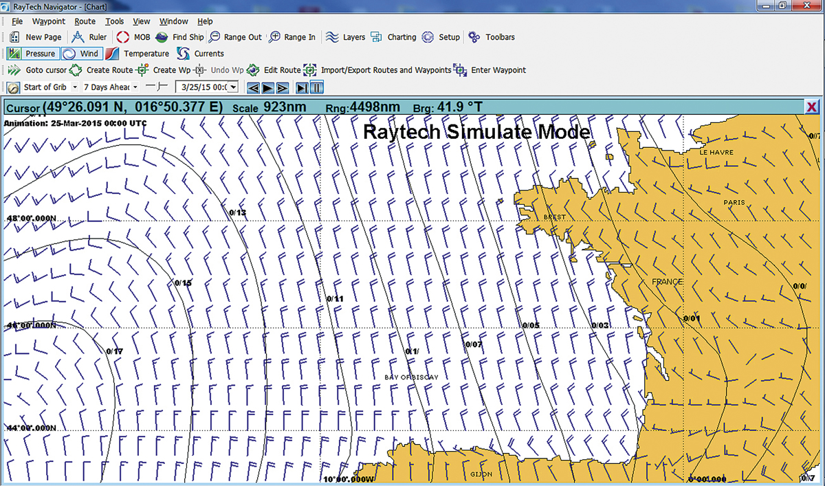
GRIB files overlaid on charting software can be downloaded via satellite or SSB with a pactor modem
There is no easy answer. SSB is part of the GMDSS network with emergency frequencies and most places in the world have cruiser nets – rallies will also have their own network. Communication with a group is easy and gives a great feeling of belonging when alone on an ocean.
Satellite communications are more personal and not part of GMDSS, but you can pick up the phone and talk to Falmouth Coastguard in an emergency, or be put through to a hospital should you have a medical problem.
The more expensive satellite systems, where data comes more in line with an acceptable speed – although still a long way from broadband – is a matter of choice and budget.
My personal opinion is the further you are from Europe the more useful SSB becomes. In the UK you need to pass a test for a radio licence which is not necessary in the US and other countries. Therefore, more long-distance cruisers have SSB radio from these nations. The US transmits a high seas forecast on SSB and once into the Pacific and heading west the availability of voice forecasts increases on SSB.
My own choices
This year to celebrate the 30th ARC my wife and I are off on an adventure which will hopefully take us to New Zealand and possibly beyond. Our budget is limited and below I detail what we have come up with. Some of the equipment was bought second-hand on eBay; other parts are new.
First we have a basic satellite phone with an external antenna. We will use this for any necessary voice communications at sea. It will also be a back-up for receiving weather pictures from the MailASail* weather system – you send a request email and get a picture back – and we will have the facility for GRIB files and email. We will use the MailASail compression software.
We have also installed an SSB radio complete with pactor modem with Sailmail subscription. It was not a cheap option, but once away from the UK it will be good to communicate with other yachts and there will always be the weatherfax back-up. Once into the Pacific communication with other yachts becomes particularly important and this was a significant part of our decision.
If I wanted a system purely for weather on specific passages then I think I would stick with my Iridium phone and laptop. Data is severely restricted in file size, speed and cost; however, from my experience of £15-20 a day for a sensible amount of weather information, it is acceptable. The Iridium GO! is an option and the decision to go with that would depend to a large extent on price plans.
The further from the UK we travel the more sense it makes to take an SSB radio. The cost of $250 a year for data is small for a livaboard who wants to keep in touch. With the latest Sailmail compression software, along with its weather portal, a little bit of patience should give good returns in weather information.
However, if budget allows, a fixed satellite system offers faster access and each megabyte becomes cheaper. The mid-range Iridium Pilot is a popular option for those who need to keep in touch. The larger systems can also be linked to a local router, allowing access from different devices.
Even with this equipment it would be good to have an SSB as well for long-distance cruising – note that most round the world rallies require it as part of the mandatory safety equipment.
*Note: Sailmail, a service useful for SSB. MailASail useful with satphone
Chris Tibbs’s set-up

For the SSB we need:
- Radio
- Tuner
- Ground
- Antenna
- Pactor modem (for emails and GRIB files)
- Annual Sailmail subscription – $250, data is then free with weekly limit
- Licence to operate (long-range certificate)
The cost of the radio and installation is around £4,000. Speed depends on modem and conditions; new modems claim 5.5kbits/s in perfect conditions.
Satphone:
- Handheld phone and external antenna costs around £1,600 plus airtime
- Older phones need a data connector (standard on new phones)
Speed 2.4kbits/s
Iridium Pilot:
- £4,200 plus mounting pole, plus airtime, but it can be 50 times faster than a satphone and data costs are greatly reduced.
With satellite phones the airtime and contracts vary greatly and matching what you need with the right bundle is critical.
See also Chris Tibbs’s advice on Atlantic routes
Chris Tibbs
Chris Tibbs has raced round the world three times, the last time as skipper of Concert in the BT Global Challenge. After a Master’s degree in applied meteorology and a spell at the Met Office, Tibbs became a full-time meteorologist with the sailing community. He has helped many racing teams and is the author of the RYA weather handbook. Still a keen racing sailor he was overall winner of the last AZAB